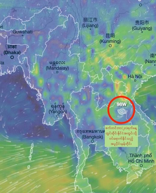
MYANMAR – The National Unity Government (NUG) warned that there could be heavy rains, flood and landslides in eastern and south-eastern Myanmar and Shan State due to the tropical typhoon and low pressure area in the western and southern Pacific Ocean.
According to the weather forecast as of 10 a.m. on September 18, the tropical typhoon and low pressure area are still present and another low pressure area is expected to form in the South Chin Sea within the next 48 hours. The tropical typhoon Pulasan in the Philippines Sea is expected to weaken after crossing the southwest of Okinawa Island in Japan by September 18 evening but would remain as a tropical typhoon then cross the South China Sea and enter the Zhejiang Province of China on September 19 night, maintaining as an inland typhoon till it reaches southern Anhui Province on September 21.
Similarly, the low-pressure area in the upper region of the South China Sea may turn into a tropical typhoon and enter central Vietnam on September 19 night, continue across northern Vietnam and southern Laos, and is expected to dissipate in eastern Thailand.
Due to those tropical typhoons, Shan State in eastern Myanmar and Karenni State, Karen State, Mon State, Bago Division, and Tanintharyi Division in south-eastern Myanmar are expected to be affected by heavy rain, strong wind, thunderstorms, floods, and landslides. As such, NUG warned the residents in those areas to be cautious of those dangers.


